Monday, March 9, 2015

The Charm Beautiful Waterfall Watu Jonggol

Watu Jonggol Tourism Village is located in Nglinggo, Pagerharjo Samigaluh District of Kulon Progo Regency Yogyakart. This waterfall is very natural and has water. Waterfall Watu Jonggol have a height of about 30-40 meters.


The crystal clear. With a distance of about 42 km from the city of Yogyakarta. Watu Jonggol waterfall is located in the mountain range incise. To reach this location visitors must pass through a path that is quite far away and a little steep. At first the road was cemented and given the stairs for easy access to the waterfall, but only up to half way, after it had to go down the stairs of rock and natural and artificial growing increasingly steep too tortuous, so footsteps must be properly addressed


Before reaching the waterfall Watu Jonggol we can enjoy the beauty of the waterfall from the top with beautiful scenery, from here looks waterfall Watu Jonggol profusely, looks like a waterfall into a level 3 which is getting increasingly torn down. After that trip will proceed down and looks bridge made of bamboo and hut that characterizes Watu Jonggol waterfall.


The beauty of this waterfall is still unknown to most people, because no one has explored this place on a large scale because of the access to the waterfall is also quite difficult, but this is the excess of this place, nature is still beautiful and there is no trash around the waterfall area. May the beauty is maintained and no ignorant hands destructive or taken that is not right.


Saturday, March 7, 2015

Kedung Kandang waterfall, Beauty Splitting Rice fields

Information on this waterfall is relatively new, and directly booming.Curug Kedung Kandang is located in the hamlet Sendangsari Putat Village, District Patuk, Gunung Kidul, Yogyakarta.


To reach the waterfall Kedung Kandang we must pass through the rice fields trekking Bendo, it is right in front of the waterfall, but trekking far enough considering we had to pass through rice fields passable path slippery and quite narrow. Trekking to the location about 20 minutes, and is recommended for visitors to always be careful in order not to damage the rice paddies stepped citizens, remember that you are just visitors and local residents do not make trouble. Bendo the rice fields trekking passes when it was quite interesting. In some streets to the waterfall Kedung Kandang we will find some streams of water flowing toward the bottom, and at that time very green rice fields and breezes.


Kedung Kandang waterfall consists of several contiguous levels resemble stair width, its shape unique and unusual location makes kedung Kandang waterfall is very special. Each level has a different height and has a small pool, although not too deep and not too clear as it may be mixed with the lime, but it does not detract from the beauty of the waterfall Kedung Kadang.


If you are still physically strong, you can go to the top of the waterfall trekking past the edge of the field, and you will find the level of the waterfall that can not be seen from below because it obstructed the highest waterfall in Kedung Kandang, and if you continue to rise you will see the flow of water from waterfall Kedung Kandang, and will certainly exhausting.

Exploration Goa Jomblang Wonosari, Yogyakarta

Capture the light beam Jomblang heaven when searching caves, it seems appropriate sentence to be a "nickname" cruising Jomblang cave this time, the light without limits can be pierced with dramatic bottom of the cave, be healers fatigue when the explorers just stopped by to sit down. Goa lies not so much untouched, little information is obtained regarding this cave, the position of the vertical cave caving cave explorers made the very need stamina and circumspection to reach the bottom of the cave. The location of the cave is not so far from Yogyakarta, just 45 km, is located in the district wonosari, Semanu position cave itself is located in the hamlet of Pacar Rejo.


To get to the location and through the cave certainly drain your stamina, but all of it will be paid when you get to the bottom of the cave, the landscape when light passes through the base of the cave is a major goal of this extreme explorers, in the cave even this can be found species of flora and fauna able to live with a little sunshine, beauty is not just up there, this cave has an aisle three, with each hallway possessed the same characteristics of natural ornaments decorated with stalactites on the ceiling of the cave, and the cave walls sloping basin resembles the other hand basin and some steep in some hallways there is water that flooded with muddy ground and a hallway that in aliri river. unique one cave passage is connected invitation another cave or cavern grubug people call within 300m of the location of the cave.


Tested the vertical sensation is the main obstacle the caver, with 50 meters into the cave and up to 85 meters in diameter, of course, required experience and expertise to the cave down, you can rappeling down a cave with a pulley and descend slowly with distance per 20 meter with manual dropping down, the guide will help you to get to the bottom of the cave.


Tuesday, March 3, 2015

Enjoying Dusk Hill Parangtritis

Trips to the beach Parangtritis sure we will see the towering hills on the east coast. The hill was named hill Parangndog. This hill can be reached about 15 minutes from the beach parangtritis by using a motor vehicle. From here visitors can see the beauty of the beaches of the coast in particular height Prangtritis. To reach this hill is quite easy because it is still a path to Parangtritis beach. From the coast counter straight on toward Parangtritis, then straight up to find a way to climb up hill into the area Panggang, Gunung Kidul. Follow the road uphill to find the fork to the right. After take a right and continue to follow the path visitors will find a home and an outpost camp after a very steep incline. From the house, visitors can park your bike and walk up the hill along the path which is next to the house. Arriving at the top of the visitor will find a hill that is hardened by concrete, that hill Parangndog. Parangndog hill is hardened with concrete because it is used for runway for paragliding, hang gliding and other aerial sports. it is not surprising when we visited this hill there who are doing the exercise or performance of air sports.


Besides being used for sporting nature, this location also offers beautiful scenery that can be seen from the heights. Visitors can enjoy the landscape and surrounding Parangtritis beach from the top of the hill. There is a spacious area on the hill that is used for grounding paragliding. This location is usually used by travelers separately assembled, take pictures, and just sat there enjoying the scenery. It is suitable for enjoying the sunset in the evening.

The beauty of the beach will be more stable when enjoyed from the top of the hill as the scenery in paragliding hills. Not complete it if visiting Parangtritis beach without visiting the hills paragliding, more details again enjoying the sport skydiving, sport adrenaline and mental courage to face height. Start trialled in parangendog cliff. Somewhat unique call to "Paragliding Hills", but the name has been phenomenal, because it is often used to perform action paragliding then that's the name that appears in the minds of the audience.


People who visited in paragliding hills not only enjoy the beauty of the beaches are visible from the top of the hill, but also for couples who do pre-wedding photo shoot and also the object of the photographer. At dusk over radiates beauty while enjoying the sunset. Look how beautiful nature is when a lot of trees and oceans clean. At the time of my visit to this place, for the first time also came, many visitors who enjoy the beauty of the beach while waiting for the sunset. It was 1600, the place was already crowded and fitted with a pre-wedding photo.

Sunday, March 1, 2015

Brown Canyon, Hidden Beauty Horror Behind Heavy Equipment

Hearing the word "Brown Canyon" we will immediately reminded of a place in the United States are very famous all over the world, the Grand Canyon. Location Brown Canyon is located in the village of Rowosari, Tembalang, Semarang bordering Pucang Gading, Mranggen, Demak. o go to Brown Canyon pretty easy though somewhat distant. If from Simpang Lima Semarang, straight road to the East until the fork to the right direction Pucang Gading Housing. Follow the concrete road to the fork in place and out of the rock truck then just follow the rocky dirt road to get to the location.Where this location has a structure similar to the Grand Canyon in America. Brown Canyon has some similar to the canyon cliffs that were in the Grand Canyon, USA.


Grand Canyon itself is one of the hidden places in Semarang. With beautiful scenery, and a row of cliffs and birds fly freely in Area this location. The location is also ideal for rock climbing. If in the Grand Canyon in the USA there is formed because scraping continuous colorado river, but if this turns in Semarang pared by humans. Erosion of sandstone rocks that are in the Grand Canyon Semarang happens because the routine activities of mining and quarrying in doing miners rock and soil that operate around here. In this Rowosari indeed be the location of excavation and rock and sand dredged from the miners instead form a beautiful cliff. The original location is not a tourist place but yes for the city that is enclosed with the daily routine, high buildings, congestion, and other air pollutants that are treated to views of nature remnants of the excavation was amazed.

Brown Canyon has the charm of a very beautiful landscape. The cliffs of the canyon in a land dominated by rocks that have unique and unique shape. This location is now one haven for photography enthusiasts. Almost every day people visit this location, either just to enjoy the view, chatting, as well as for hunting.


Brown Canyon does have a charm of extraordinary beauty, but it also saves a sad story that scour the land that occurs continuously, which of course will affect the ecosystem. Regardless of the benefits that can be obtained by the public. Does not rule out the possibility, the next few years the cliffs at this location will collapse or are extracted by heavy equipment that every day destroys soil structure and stone here. So it is still there and still looks beautiful, should we took time to visit, view and to preserve its beauty before it will be destroyed.

Saturday, February 28, 2015

Segara Anakan Beach , The Beauty Behind The Cliffs, The island Sempu


Sempu Island is one of the tourist destinations in Indonesia are required to visit. Sempu Island is located in the south of the Sendang Biru Beach Malang, East Java Province. To reach this Sempu Island are suggested to bring a personal vehicle, because the island Sempu is located approximately 69 km from the city of Malang. The trip to this Sempu island takes about 2 hour trip. However, the journey to the island Sempu is not easy. Visitors should go to the Sendang Biru beach first, visitors should hire a boat to continue the trip to the island Sempu. Sempu island itself has an area of about 877 hectares, and is a nature reserve under the auspices of the Natural Resources Conservation Center East Java province. Because Sempu Island was used as a nature reserve, the island is only inhabited by the flora and fauna. Therefore, islands and beaches in this still natural place.


From the blue spring beach, visitors must request permission in Conservation Areas Sempu Island Resort, which is located not so far from daycare vehicle. Next trip to the island Sempu use this boat, takes about 15 minutes. During the journey visitors will enjoy a very impressive scenery. Visitors will be treated to beautiful beaches and hills in clear overgrown trees. Furthermore, for the second trip, the visitor will travel around 10-15 km. The journey through the forest in this extremely challenging Sempu Island, it is advisable to follow the direction of the visitor Guide.


And this is the main tourist destination Segara Anakan Beach, the journey that it will not feel heavy when visitors arrived at Segara Anakan. Visitors will see the beauty of pure white sand, crystal clear water colored beaches, big waves are not accompanied by a large number of fish passing. Then on the beach Segara Anakan widely used visitors to freshen up. Segara Anakan is a beach overlooking the Indian Ocean, but because it is separated by a cliff then be as if separated from the beach so as naturally enclosed swimming pool. And when visitors slightly up on the cliff, visitors can see a view of the sea off the Indian Ocean are very beautiful.

Friday, February 27, 2015

Pok Tunggal beach, Beauty Behind Two Cliffs

The name of Pok Tunggal Beach of of foreign is still sounded in our ears. The beach Pok Tunggal is indeed of new beach in a row beautiful beaches in the area Wonosari. This Pok Tunggal Beach began accessible to tourists in 2012. Beach is located on the Village area Tepus, District Tepus, Gunungkidul, Yogyakarta. Wonosari The distance of about 50 km. The reason why this beach called beach Pok Tunggal is a Pok Tunggal name is derived from a large tree Duras, and to this day still stands at this beach, so this tree into icon or characteristic of Pok Tunggal beach.


Although the journey to this beach must pass through the steep and rocky, but comparable to what visitors get this Pok Tunggal  Beach. White sand stretches of cliffs west to east cliff. Pok Tunggal beach is flanked by two towering cliffs. If cliffs west has made way with casted and equipped with several gazebo to the right-and left the road, another case with cliffs on the east because of the slope up to 90 degrees. A tree is seen standing among thousands of sand on the beach, which seemed to have become an icon of a Pok Tunggal beach. Pok Tunggal beach is not too extensive, but visitors can perform various activities in this place. Here visitors can perform activities such as swimming, water play, or chatting with family or partner. Even for visitors who have the guts and adventurous, can climb the cliffs on the east side. The cliff has a slope of 90 degrees with a height of 50 meters. This cliff is a potential for rock climbing activities. And above this cliff, also provided a place for visitors who want to enjoy the view over the cliff.


Enjoy the beauty of the beach Pok Tunggal less complete if visitors do not enjoyed the beauty of the sunset or sunrise. Sunset or sunrise at the beach Tunggal Pok is not less interesting than the sunset or sunrise elsewhere. On this beach also provide tent rental for Visitors who want to stay in Tunggal Pok beach. Pok beach Tunggal The management is deliberately not build buildings for lodging on the grounds that the tourists who spend the night in this beach using a tent that blend with nature.


Golden Sunrise Mountain Peak Sikunir Dieng, Wonosobo


Sikunir mountain peak located in Sembungan, District Kejajar, Wonosobo. Location mountain top Sikunir itself, is around 8 km from Dieng that takes about 45 minutes to 1 hour to the summit Sikunir. Sikunir the top of the mountain at an altitude of 2,300 above sea level. Here we can clearly see the blend of scenery between Mount Sindoro, Sumbing, Merbabu, and Mount Merapi. Sikunir mountain peak itself is the best place to enjoy the sunrise in Central Java, so many people who climb this mountain to see and enjoy the sunrise and rows of beautiful mountains. Panorama natural attractions offered by this Sikunir mountain peaks, it is really tempt for visitors. Here visitors will be amazed at the shape of the pattern of light that conjure up images of Mount Sindoro, Sumbing, Merbabu, and Mount Merapi will not be the same as the sunrise at any place, therefore so called Special Sikunir Sunrise. Visitors are advised to climb the peak Sikunir should be at 04.00 am. the visitor does not need to be afraid to climb this mountain in the morning, because there are many other visitors who set up tents in advance so as not to rush.


Many ways can be done to reach the summit of Mount Sikunir. To get to the tourist area of the town of Wonosobo Dieng Plateau, you can ride public transportation or small bus. Dieng down at the T-junction and then forwarded to ride motorcycles as far as 7 miles to the village Sembungan, or can be delivered to the parking lot in the area of Lake Cebong. For private vehicles, the road that must be taken of the area is to Dieng Plateau Dieng Theater then continue to follow the road to the village Sembungan, then to the lake Cebong. From the parking lot at the lake this tadpole you just climb to the top with a distance of approximately 800 meters commonly takes around 45 minutes until 1 hours. Access road to the village Sembungan are not too good, less light at night and a bit holey.

Thursday, February 26, 2015

Natural Coolness Umbul Sidomukti, Ungaran

A beautiful bathing pool with interesting formations located at an altitude of 1200 above sea level, is flanked on each side of the gorge on the slopes of Mount Ungaran. An area located in kabupaten areas Semarang Central Java, which can be traveled one hour drive from the city of Semarang.  This tourism area more precisely in the village Sidomukti, subdistrict Bandungan. Tourism area offering views of nature, natural pools that continues to flow, the location outbound challenging.With the cool air and stunning scenery overlooking the expanse below it, this bath is quite right into a physical and psychological relaxation in the area of Semarang.


The bathing pool has its own advantages that are rarely found in other baths. Cool air makes the atmosphere in Umbul Sidomukti quite relaxed. Located in the slope of the mountain, this pool has a unique formation. Umbul Sidomukti bathing pool with crystal clear greenish blue water, in the form of terraces and has four tiers pool. With small mountain river rock walls, baths Umbul Sidomukti fresh feel natural. Fresh and cool water that comes directly from the mountains into the landscape, into the pool through the beautiful glow that the main attraction for tourists.The water out of the bottom of the pool to form a fountain and then fill the pond water clarity and flow of the pool highest to lowest. Highest swimming pool which is the largest and most in tourists dominated by adults. The highest water from the pond into the second, more shallow pool with waterfall formations that beautify the the formation of pools. So is on until the pool to four. Aside from the pond itself, the surrounding natural scenery presented is equally interesting and enjoyable when we enjoy the fresh and softness baths. Being in a rural area of the highest point of the locals make offerings rural views can be enjoyed from a height. Range of traditional village houses look tidy and beautiful from above. Terraced agricultural system in the form of the appearance of lines and the terraced hills writhed in the valleys are home vegetable and flower gardens also seem amazing as a local sights. Background Umbul Sidomukti itself was no less interesting. Ungaran mountain towering behind it adds a sense of freshness with a cool mountain winds blowing out of the trees are green pine forest that surrounds the body contortion mountain that come into contact with fog clouds on it. Other than that, because it is located at an altitude plains sloping, relax your body in fresh water bath Umbul Sidomukti feel like in a giant balcony with views of the exotic treat a very wide and deep down there in the form of Semarang basin surrounded by mountains at its edge. Can we count the scenery in front of us, a stretch of urban to rural districts of Semarang, Merbabu Mountain, Mountain Andong, Mountain Telomoyo, Rawa Pening, twin hills Cemanggal, Mountain Moriah, becoming the most beautiful corners of the balcony.


Other than that, in the north swimming baths, there is a wide and the gaping chasm. But the eerie impression is not settled and the flow in the depths of chasm. Actually a lot of interesting games arena manager at Umbul Sidomukti tourist rides in the chasm. In between games or game-supplied include flying fox with two tracks, marine bridge in the valley, rappelling down the valley, and ATV. Flying fox in Umbul Sidomukti quite challenging adrenaline. With a path length of 110 meters, the distance from the lowest point of the valley height of approximately 70 meters. The flying fox across the valley so that it feels as if moved from the hillside to hillside across and then continued back to the foot of the hill early. Other than that, tourists can also enjoy the experience of horse riding around the area Umbul Sidomukti.


Wednesday, February 25, 2015

Natural Charm Forest Tourism Kalibiru

Kalibiru a forest tour Menoreh Hills is located in Kulon Progo, Yogyakarta (DIY) and lies at an altitude of 450 meters above sea level. Kalibiru forest tourism is located approximately 40 km from the city of Yogyakarta or about a 10 km from the city Wates, making access to the tourist area of Forest Tourism Kalibiru fairly easy. From Yogyakarta, visitors only takes about 60-90 minutes to reach this tourism object. From Wates, the capital of Kulon Progo Regency, visitors can down the road leading to the Sermo Reservoir, there will be a signpost towards Forest Tourism Kalibiru. The forest area in the beginning a barren state forests, because of illegal logging. People living around this area then took the initiative to keep the forest in order to remain green, cool, and everlasting, by managing forests tourism are then called Kalibiru. Therefore, Forest Tourism Kalibiru a community forest, the state-owned forests are managed by the community.


During its development, Forest Tourism Kalibiru are equipped with variety of facilities to attract tourists. The natural beauty that blends nicely with the local wisdom and culture of rural communities, that is trying to be appointed by the manager. As a result, a promising area of Forest Tourism Kalibiru travel packages, such as rural tourist, cultural tours, educational travel, family travel, tourism, tourist also natural therapies.


Forest Tourism Kalibiru located at a higher location than Sermo Reservoir, so tourists who visited the Sermo Reservoir can see the beauty of height. Other than that, the main attraction of this area is a beautiful landscape and enchanting. In this place, visitors will find a harmony between the green expanse of forest with valleys and hills beyond, and vast stretches of blue sky. The more beautiful natural panorama when combined with the environment surrounding rural communities Forest Tourism Kalibiru friendly, polite, and still uphold a sense of family and the value of mutual cooperation.For visitors who want to relax and enjoy the scenery, you can walk to the viewing post located at an elevation. At the highest viewing post, you will see the scenery very spacious with views ranging from Sermo Reservoir, forest, houses look so small from above, fields, hills, and forests. Forest Tourism Kalibiru is very suitable to be enjoyed for families and couples.


Monday, February 23, 2015

The beauty of the southern coast of East Java, Klayar Beach Pacitan

Klayar or Klayaran beach is one of the loveliest beaches in Pacitan, East Java southern coast and adjacent to cities Wonogiri, Central Java. More precisely in the village of Kalak, sub-district Donorojo, Pacitan East Java. The distance is about 40 km to the west of cities of Pacitan. And if from the direction of the city of Yogyakarta can be traveled 3 hours by road to the east. Because not yet known extensively, Klayar Beach is still relatively deserted. This beach crowded in the visit during the holiday season or day weekend.


Klayar Beach save the beauty its unique. With stretch of white sand, the sea flute emerging from rocks, large rocks that resemble the Sphinx in Egypt and natural fountains. Besides enjoying the beauty of the beach with a walk by the beach, the visitors can climbed the cliffs or hills on the west side beach Klayar and then enjoy the beautiful view of the sea from the top of a hill surrounded by a sea of blue. The eastern side of beach Klayar visitors can find a large the coral resembling the Sphinx in Egypt. In addition, visitors can find a natural fountain from a hole in the coral southern ocean waves crashing by a very strong. This natural fountain can reach a height of 10 m, depending on the strong gusts of ocean waves. Other than that this fountain can emit sounds resembling whistle, so that the local people is called the sea flute.


However the location of the fountain is very dangerous if be passed at the time of sea water in tides. But the beauty of the  Klayar beach is very suitable  to be enjoyed. Widely available beautiful the spot to get a good photo. Surfers will also love this beach because the waves are big

Sunday, February 22, 2015

The beauty of the Umbul Ponggok Klaten

Umbul Ponggok located in Village Ponggok, District Polanharjo, Klaten, Central Java. Approximately can be achieved 1 hour drive from the city of Yogyakarta. Were treated to a view of typical rural roads, green rice field, and the cool air. Umbul Ponggok is the largest artificial bathing pool in Klaten with an area of approximately 6000 meters. The existence Umbul Ponggok has been around since the days of hundreds of years ago, in ancient times used for irrigation Umbuk Ponggok cane plantations, and at this time Umbul Ponggok function is as an object bathhouse. Other than, that the depth of Umbul Ponggok is also varied, to the outskirts of approximately 0.5 meters to 1.5 meters and is getting deeper and deeper into the middle, with a depth of 3 to 4 meters. 


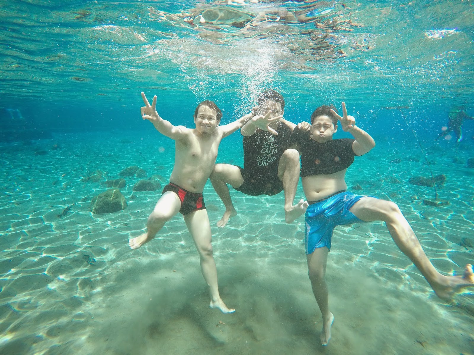
The excess Umbul Bannerman Ponggok is water from the springs is derived from proper under Umbul, therefore water in Umbul Ponggok very clear and clean, so that from the top of umbul we could see the bottom of Umbul Ponggok very clearly. Another advantage of this umbul is the basis of Umbul Ponggok dominated by stones, gravel, moss and sand so it looks like in the sea. The excess of the latter is an Umbul Ponggok It contains hundreds of freshwater fish the size of a little finger up to the thigh adults, the fish of the pennant is not dangerous, even they are already accustomed to human presence. No one if Umbul Ponggok is nuanced springs in the ocean, with hundreds of fish, large rocks, sand bottom umbul, very clear water, and if the sun is hot, the occasional sunlight into the clear water of Bannerman Ponggok the beauty.


Other supporting facilities around the area Umbul Ponggok enough complete, there are facilities equipment leasing and snoorkling camera under water, 4 bathrooms that can be used to shower after swimming satisfied, there are several food stalls selling a variety of food, a few benches and a place to rest, but the area is still minimal Umbul Ponggok trash, so some visitors throw garbage anywhere, and worse still there are visitors who throw garbage in the pennant, hopefully supporting facilities in Umbul Ponggok more complete and visitor awareness of hygiene tourist area higher for the convenience of all visitors and for the sake of cleanliness of this place. Umbul Ponggok currently not too crowded, most visitors still dominated by the surrounding community, therefore this place could be a reference to fill or fill holiday weekend.